The roads are mostly quiet and well paved, though there's traffic near the visitor's center it's only for a couple of miles. Skipping the loop into Lake Guntersville park reduces the mileage to 53 miles.
| Cue Sheet | Map | BikeRouteToaster |
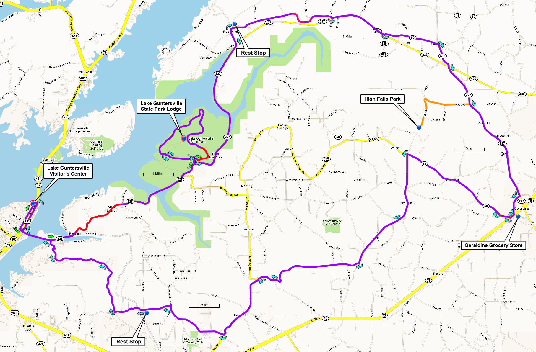
An alternate start point from the lodge at Lake Guntersville State Park explores some more interesting roads but the park is located 10 miles further from Huntsville.
This ride begins at the visitor's center in north downtown Guntersville, about a 30-minute drive from the Sutton Road intersection near Hampton Cove (Walmart/Publix). From Hampton Cove, travel south on US-431 28 miles to Guntersville. The visitor's center is the first building on the right, just after crossing the bridge and entering town.
Google Maps driving directions to the visitor's center in Guntersville