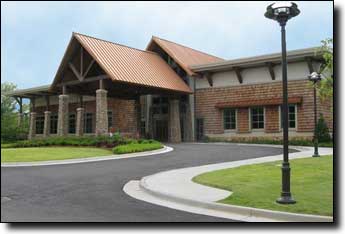
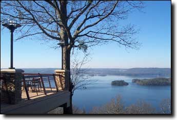
The ride starts at the lodge in the Lake Guntersville State Park. Having recently completed a $25 million renovation this is a very nice start point and the Pinecrest dining room offers a breakfast buffet weekend mornings from 6:30 to 10:00 am for $8, menu only on weekdays.
Warning: A bridge on CR-44, between Langston Gap and Bucks Pocket, is currently out. You can bypass it by continuing on CR-38 after the climb, for 2 miles, then Right on CR-41 for 1 mile, Right-Left onto CR-44 for 1 mile, then left onto CR-152, returning to the route. This detour only adds a mile.
| Cue sheet | Route map | Google Earth file: KmzGuntersville.kmz |
BikeRouteToaster |
There's a 54 mile version that shortcuts back to the park and a 76 mile version that adds some mileage in the middle. An alternate start point in downtown Guntersville is ten miles closer to Huntsville but adds ten miles and an additional climb to the route, a metric route from the visitors center skips some nice roads for a shorter distance.
Those wishing to ride from the park but avoid long climbs can ride north along the lake on AL-227 and CR-67 (Google Maps or Alabama Tourism Department map) parking at the Beach Pavilion parking lot to avoid the climb up to the lodge. It's a pleasant and scenic ride for any distance up to 52 miles, out-and-back, mostly rolling hills.
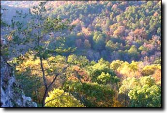
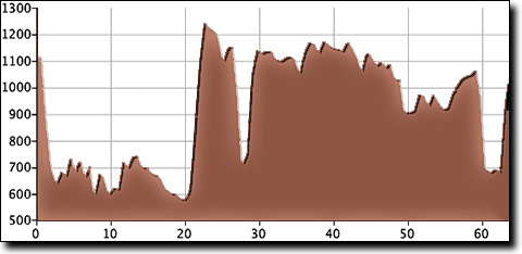
This route begins with a descent to a counter-clockwise tour of Lake Guntersville state park, then travels north along the lake and through farmland to the first climb at mile 20, up Sand Mountain at Langston Gap (topo), gaining 600' in 1.4 miles for an average grade of 8%. This is a pleasant tree-covered climb on a quiet road.
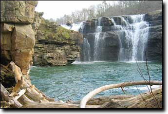
The route then turns south for a few miles of rougher pavement, dropping down into the Buck's Pocket State Park at mile 27 for a rest stop at the picnic area (restrooms with water and coke machine but no food). Just before the park the road can be under water if there have been recent heavy rains, though it's usually passable on a bike.
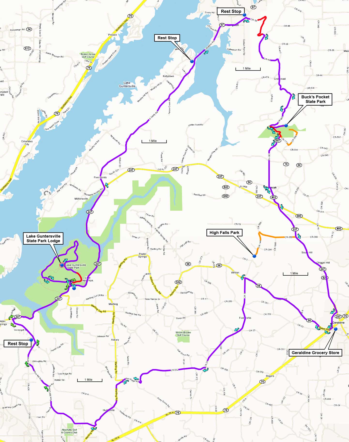
The total elevation gain is 2,950', starting at 1,120' with a maximum elevation of 1,240'.
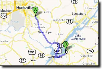
This ride begins and ends at the lodge in Lake Guntersville State Park, about a 50-minute drive from the Sutton Road intersection near Hampton Cove (Walmart/Publix). From that intersection:
Travel south on US-431 29 miles into downtown Guntersville. Turn left at AL-227/Lusk Street and travel 7.1 miles. Turn left at Aubrey Carr Scenic Drive into the Lake Guntersville state park, turn right just inside the park and travel uphill 1.6 miles past a golf course to the Lodge on your left at Lodge Drive:
Google Maps driving directions to:
The Lodge in Lake Guntersville State Park
1155 Lodge Drive
Guntersville, AL 35976