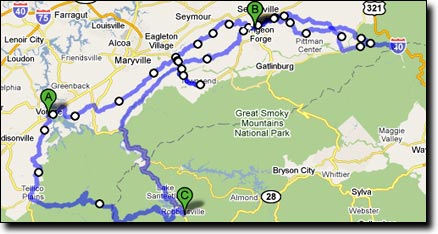
Vonore Tennessee is a 3-hour drive from Huntsville. Staying in Sweetwater the evening before makes for a more relaxing first day, it's a short drive to Vonore. Parking in Vonore is next to the Vonore police station, at the Vonore Community Center (Google Street View).
| Day | Miles | Start | End | Stay |
| 0 | Drive | Huntsville | Sweetwater | Quality Inn |
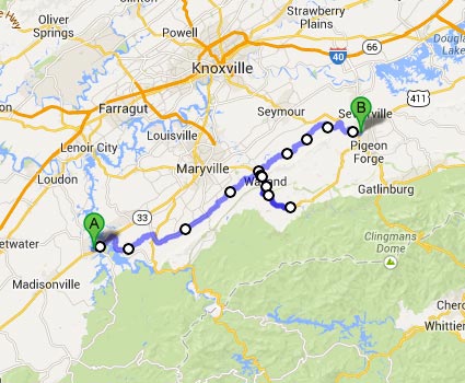
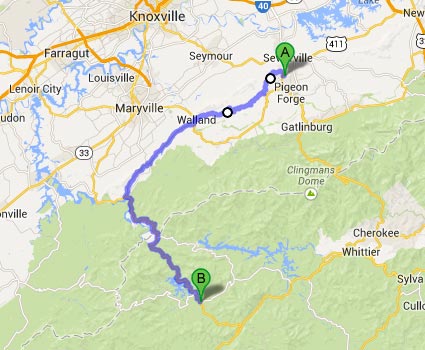
| 1 | 74 | Vonore | Sevierville | Days Inn |
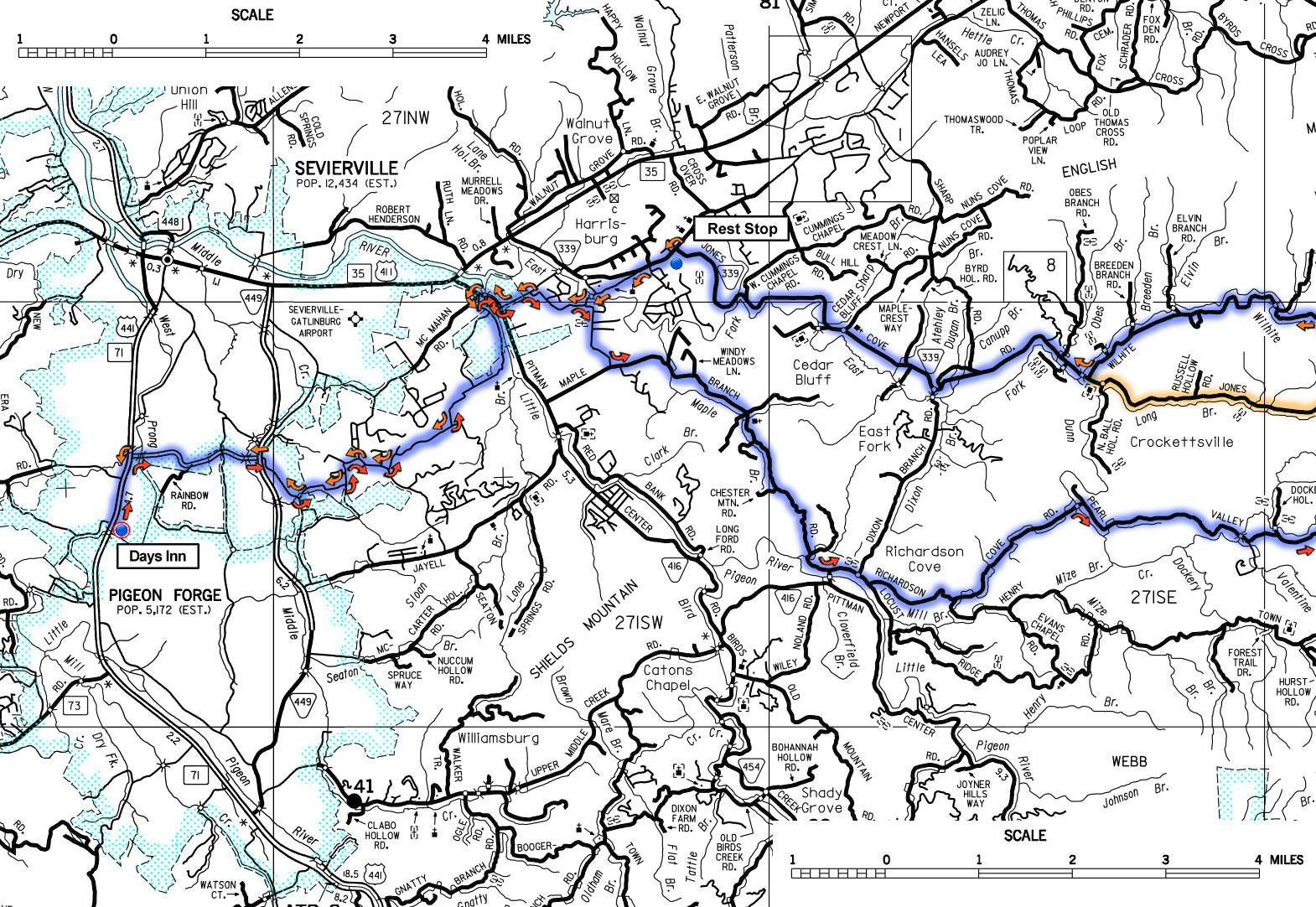
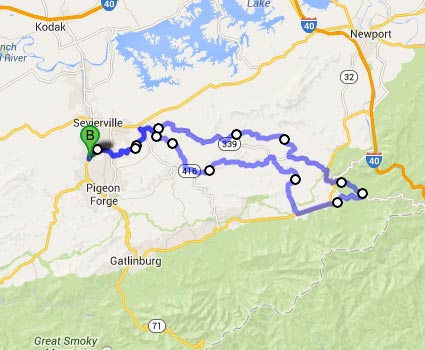
| 2 | 90 | Sevierville | Loop (shorter options) | Days Inn |
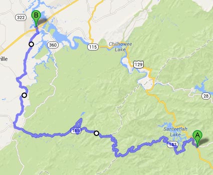
| 3 | 71 | Sevierville | Robbinsville | MicroTel |
| 4 | 74 | Robbinsville | Vonore | Drive Home |
Elevation Profiles: - 24,400' in 309 miles (RideWithGPS)
- Vonore to Sevierville - 4,170' in 74 miles
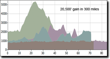
- Cherokee Forest Loop - 6,760' in 90 miles
- Sevierville to Robbinsville - 6,750' in 71 miles
- Robbinsville to Vonore - 6,720' in 74 miles
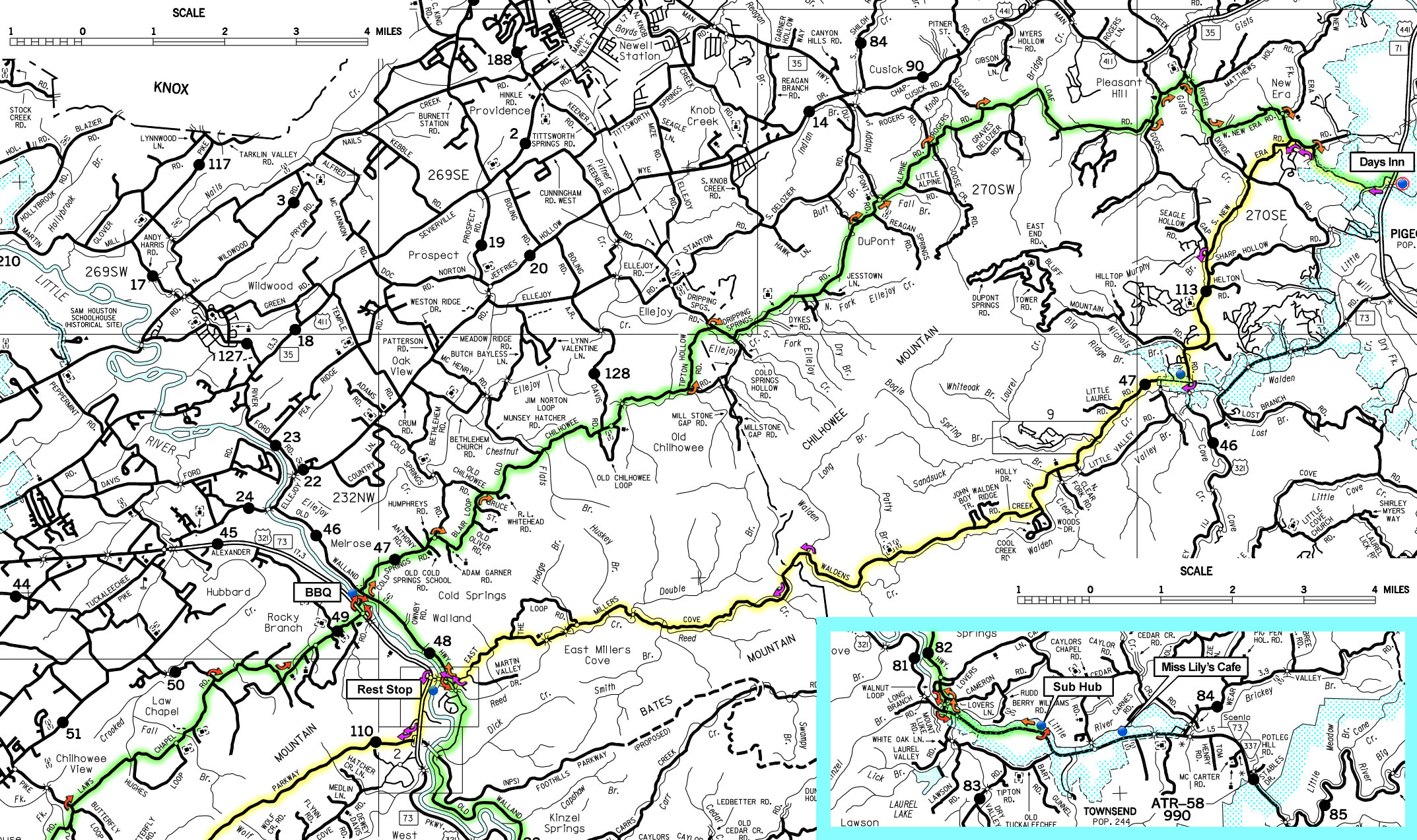
While most of the roads on this tour are lightly traveled, Sevierville is located adjacent to touristy Pigeon Forge so traffic increases in that area. There's a bike shop in Sevierville, 4 miles from the hotel.
An extra day in Robbinsville could be added to ride the Joyce Kilmer metric loop, or a day in Tellico Plains to explore River Road along the Tellico River to the North Carolina border.
It's a good idea to carry a full set of the maps, and I highly recommend the RideWithGPS phone app for navigation, superior to cue sheets.
Breakfast at the Quality Inn & Suites in Sweetwater, lunch in Townsend at 42 miles, dinner at the Applewood Farmhouse Restaurant a short walk from the Days Inn Apple Valley in Sevierville (fast food also nearby).
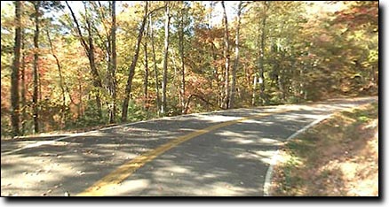
The route travels on mostly quiet backroads, very hilly but no long climbs, gaining a total of 4,170'. The ride can be shortened to 53 miles by skipping the out-and-back to Townsend, though the road to Townsend is a worthwhile detour, it's a quiet scenic road along the Little River.
|
|||
Breakfast at the hotel or IHOP, lunch on the road. Second night at the Days Inn Apple Valley in Sevierville.
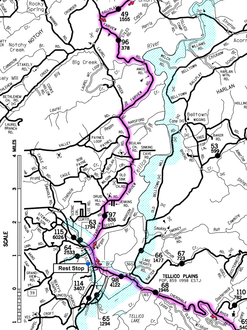
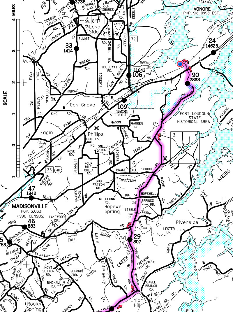
This day's ride travels west into the Cherokee National Forest, on the north border of the Great Smoky Mountains Park. The road into the Cherokee National Forest is quiet, curvy and scenic, ending at the border with North Carolina. It can be skipped to shorten the distance to 74 miles. The full route includes four long climbs, with a total elevation gain of 6,760'.
|
|||
Breakfast at the Applewood Farmhouse Restaurant or IHOP, lunch on the road at Deals Gap at 53 miles, dinner at Lynn's Place on E Main Street, a quarter mile walk from the hotel.
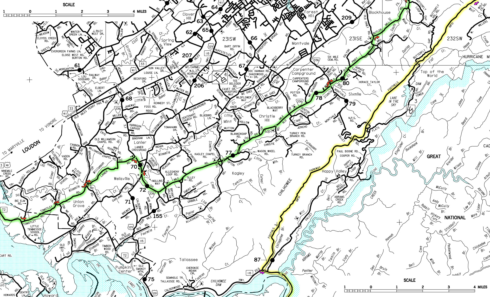
This route travels via the Foothills Parkway and the Tail of the Dragon to Robbinsville, North Carolina, stay at the MicroTel.
This is a very hilly route with several long climbs and a total elevation gain of 6,750'. The climb up the Foothills Parkway is the longest, 8.5 miles gaining 1,900' at a mild 5% average grade (not counting a two mile break that starts at 3 miles). After topping out, with a few hills on top, the Parkway descends at 5% for 5.3 miles. Motorcycle traffic can be expected along the tail of the dragon.
Cue Sheet - Maps: Same as Day 1
|
|||
Breakfast at Lynn's Place, lunch in Tellico Plains at mile 54.
This route returns to the start in Vonore, traveling west over the long climb on the Cherohala Skyway and through Tellico Plains, following the Cherohala Challenge century route. The route gains 6,720' (and loses 7,870') with the Cherohala Skyway gaining 3,430' in 11 miles.
|
|||