Variations:
A similar route that doesn't climb Grant is the Road to Nowhere. A route that explores more of the backroads on top of Grant is the Chestnut Grove - Grant Metric. The Damned Grant ride is a Halloween version of this route.
Route Details:
Most of the roads are lightly traveled with good pavement but there's a 2-mile section of rough pavement on New Hope Highway South. The route includes two short sections on Highway 431, a high-speed 4-lane highway, but there's usually light traffic; there's a wide shoulder but it's rough.
The one non-optional climb is Cottonville Road which has a 7% average grade with a couple of steep switchbacks near the base. The descent on Babe Wright is possibly the fastest in the area, but watch out for gravel in the gentle bends at the top. It finishes with a straight drop on great pavement.
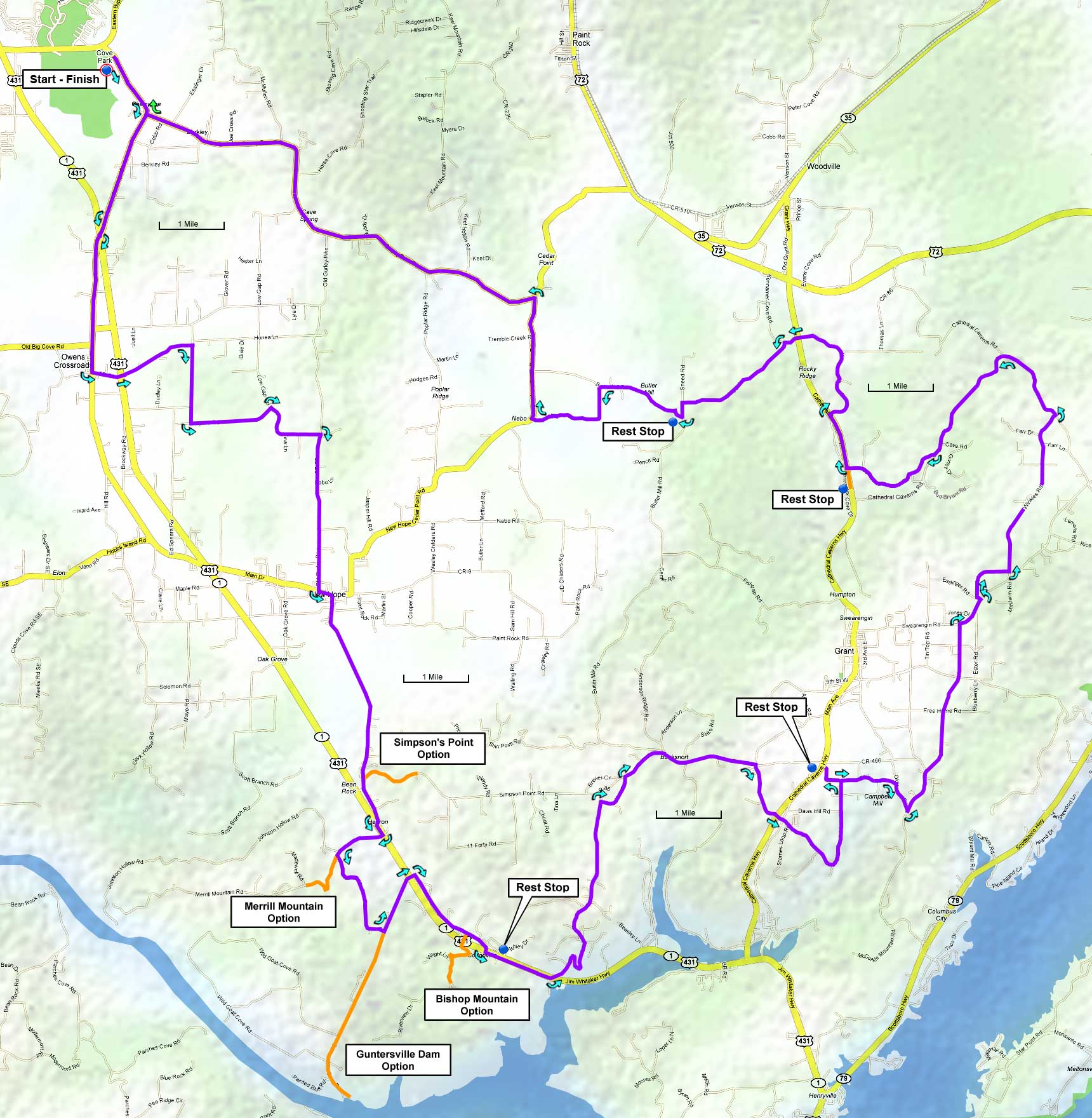
- Simpson Point - 1.0 mile with a 10% average grade
- Merrill Mountain - 0.9 miles with a 10% average grade
- Bishop Mountain - 0.7 miles with a 9% grade
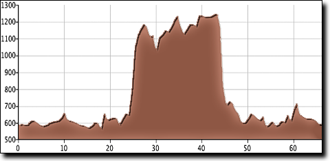
The total elevation gain is 1,860', starting at 580' with a maximum elevation of 1,250'.
| Cue sheet | Route map | BikeRouteToaster |
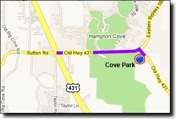
The Cove Park ballfields near Hampton Cove:
If traveling over Monte Sano on Highway 431 (east on Governors Drive): go 4.8 miles after passing Monte Sano Boulevard and turn Left at Old 431/Sutton Road. Travel 1.6 miles and turn right onto Old 431. The ballfields are on the right.
If traveling over Cecil Ashburn Drive: continue straight on Sutton Road for 0.7 miles and go straight across Highway 431. From the intersection go 1.6 miles and turn right onto Old 431. The ballfields are on the right.