Cue Sheet Map BikeRouteToaster
Route details:
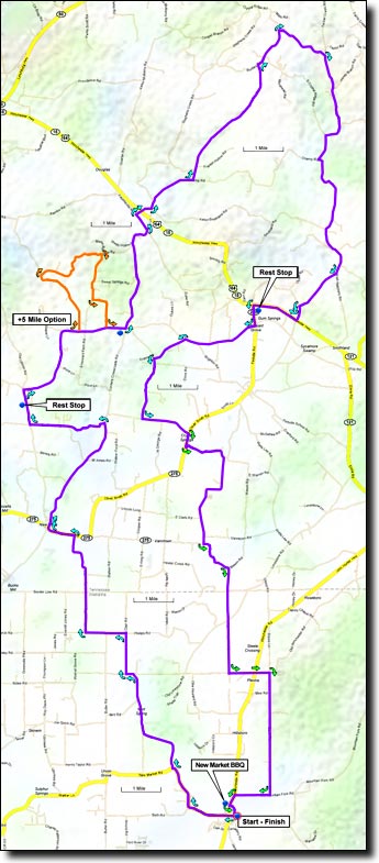
The ride begins with rolling well-kept farm country, then enters Tennessee on mostly flat roads up to the first rest stop. After the rest stop there's an option to add 5.5 miles and a 250' climb, shown in orange on the map (66 Mile Cue Sheet). The route then gradually descends a few miles to the small town of Kelso at US-64, followed by rolling hills and a long climb leading up to the northern most point of the route along Crystal Ridge.
Turning south the road gradually descends for several miles before climbing back up before the second rest stop. After the second rest stop the route is mostly rolling all the way back to New Market.
The New Market BBQ is a great place to eat after the ride. It's located a quarter mile north of the school on the west side of Winchester road.
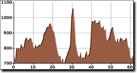
The total elevation gain for this ride is 1,500', starting at 750' with a maximum elevation of 1,070'.
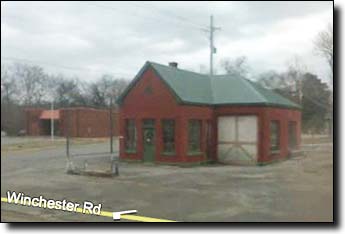
This ride starts at the New Market elementary school (Google Maps location), just off Winchester Road at old downtown New Market. Arriving from the south on Winchester Road, turn right onto New Market Road. There's a flashing yellow light and an old red building with a green roof at the intersection.