Cue Sheet Map BikeRouteToaster
A shortened route (57 mile Cue Sheet) bypasses the north-most roads, shown in orange on the map.
This route is a modified version of Jim Everts's popular Bunker Hill ride, an 85 mile route that starts from Creekside Elementary, available on the SCCC Database. Thanks Jim!
Route details:
The ride starts just off AL-53, a couple miles north of the popular Sparkman Middle School ride start. It heads west through rolling farmland, then hits a couple of long straight roads through Limestone County.
The route then turns north to the first rest stop in Elkmont. There's some rough roads not long after the rest stop, then the route winds it's way back east on mostly good pavement with lots of hills. There's a long hill a few miles before the second rest stop at the Giant Chicken truck stop.
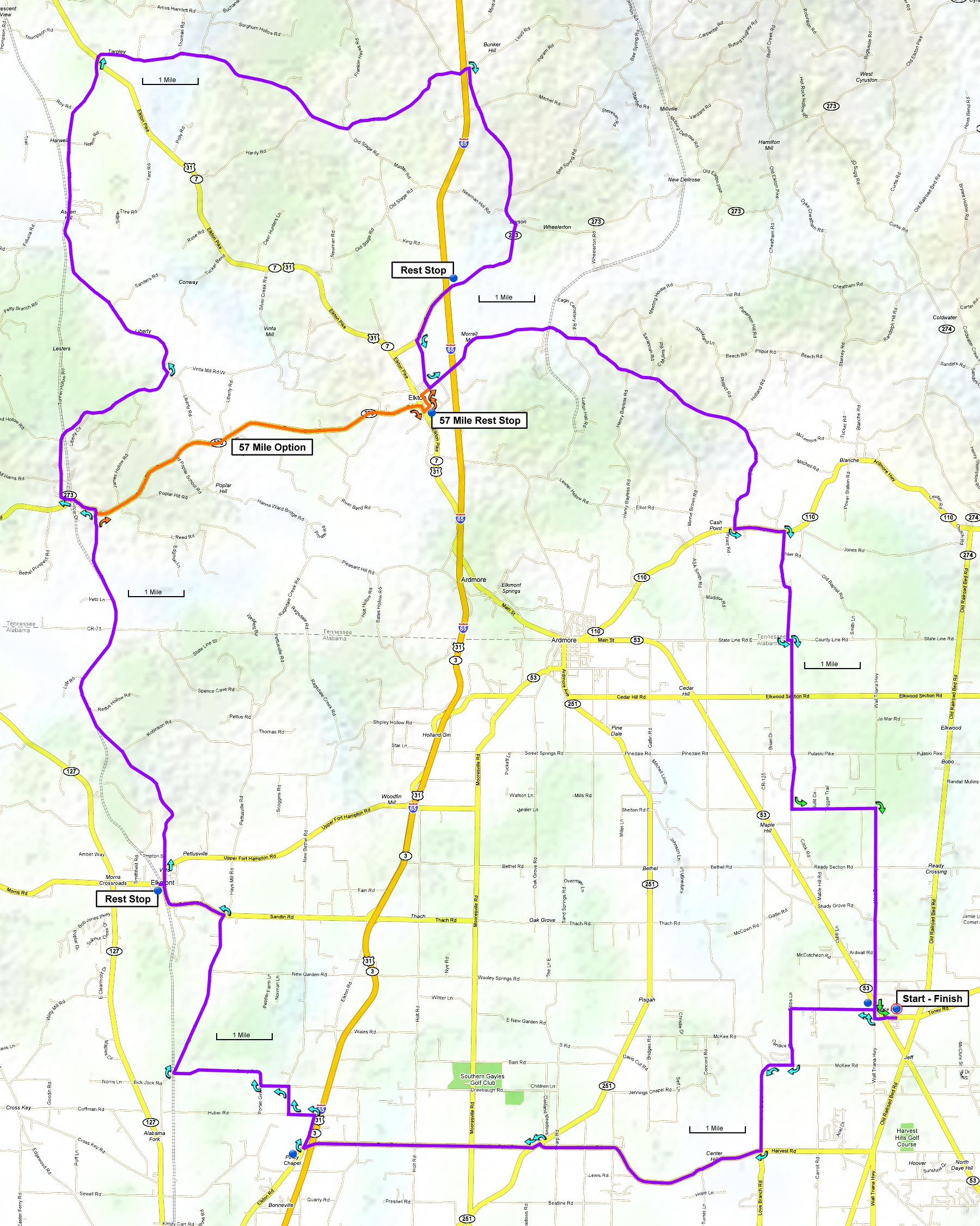
The ride finishes with some long straight roads heading south, with a couple of hills within a few miles of the finish.
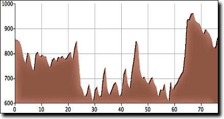
The total elevation gain for this ride is 1,660', starting at 850' with a maximum elevation of 950'. The total elevation gain may not be accurate for this ride since it has so many small hills, this ride is hillier than the numbers imply.
This ride starts at the Harmony Baptist Church (Google Maps location) in Toney, a quarter mile east of AL-53 on Toney Road.
From Huntsville and I-565: take Research Park Blvd north 6 miles, then Left/North on AL-53 / Jordan Lane for 8.4 miles. Turn Right at Toney Road at the flashing yellow light and travel 0.25 miles, the church will be on the left.
