The route has some moderately rough roads, most along the first six and last twelve miles, with some dogs that chase on those sections as well. The first rest stop at mile 23 is at the Jackson County Park on Lake Guntersville, a pleasant stop with picnic tables. There are public rest rooms and a restaurant with outdoor dining nearby (the restaurant is currently closed).
A short detour to the downtown courthouse square in Scottsboro around mile 42 also offers a couple of good lunch options, though they're closed Sundays. Turn left from E Maple Avenue onto N Broad Street to reach the square a couple of blocks to the south.
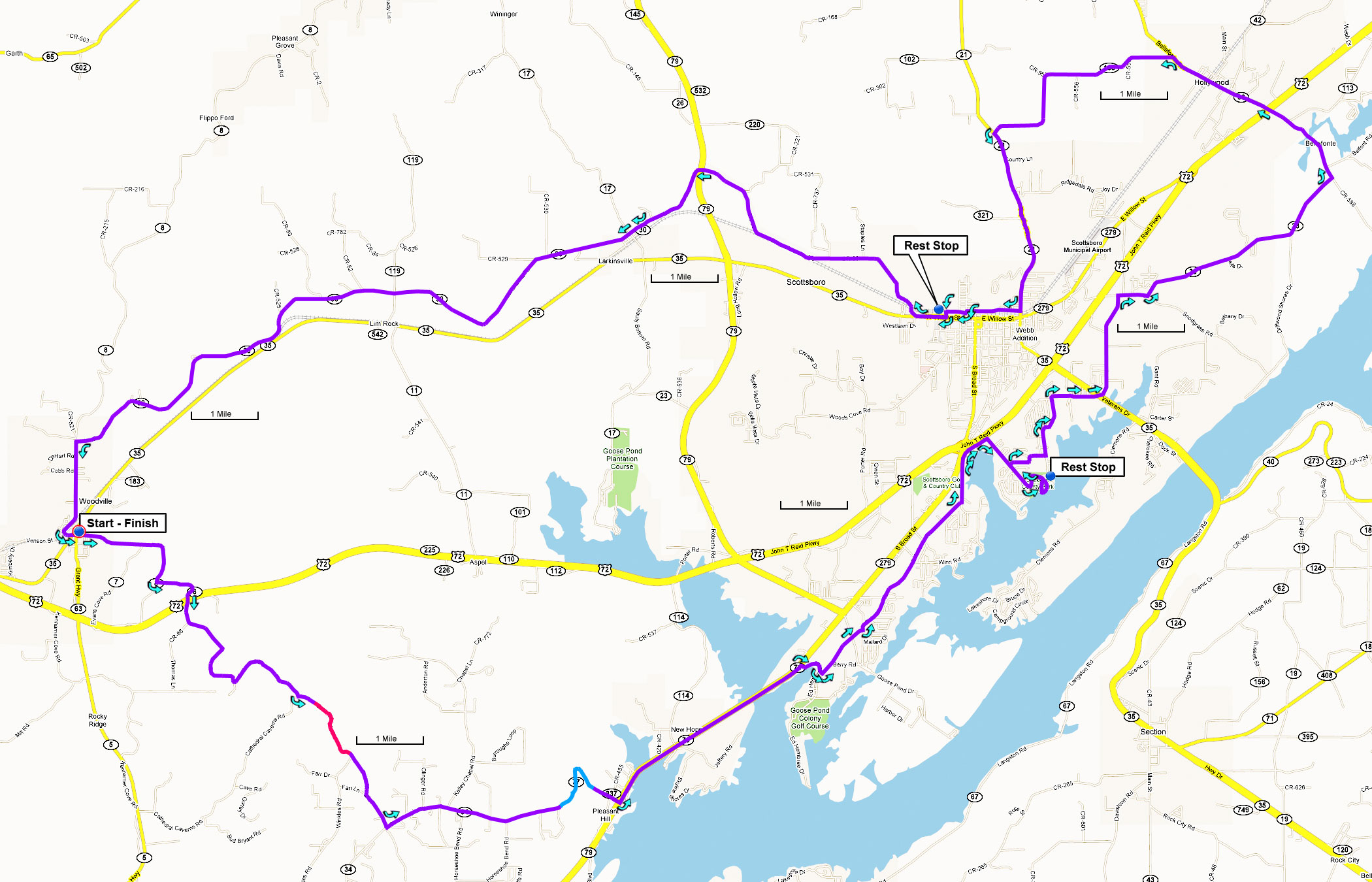
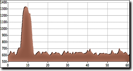
The total elevation gain is 1,600', starting at 590' with a maximum elevation of 1,330'.
This ride starts at the Woodville Municipal Building in Woodville (Google Maps location), 30 minutes east of Huntsville.
From I-566 East continue east on US-72 20.3 miles, through Gurley and Paint Rock. Turn left at AL-35 / Willow Street and go 1.8 miles to the intersection with the flashing yellow light. The Woodville Municipal Building is on the right, it's a small parking lot but there's additional parking nearby.