Warning: The rest stop store at mile 31 is currently closed, leaving only one rest stop at mile 48. You may find water or drinks at the Circle E ranch store a half mile south of the closed store. There is an alternate route that travels to a store at mile 39, but it has some rough pavement.
Route details:
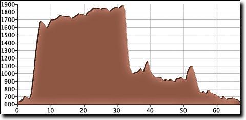
The route's main climb is 2.7 miles with a 7% average grade, beginning four miles into the ride. After the climb (and a couple of bonus hills) there's a convenience store at the AL-79 intersection (currently closed).
The route then heads north on top of the Cumberland Plateau for 22 miles, gradually gaining elevation into Tennessee and the next rest stop (also closed) before descending into the farmland below. There are a few rough patches on the descent.

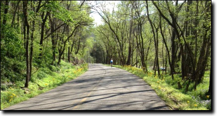
From Huntland the route returns south along one of the most isolated and beautiful roads in the area, rising and dropping along the Larkin Fork Creek and the Paint Rock River, winding its way back to the high school.
| Cue sheet | Route map | Google Earth file: KmlHytop.kmz |
BikeRouteToaster |
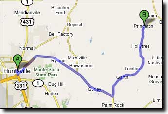
The Paint Rock Valley High School is located about 45 minutes from Huntsville in the small town of Princeton. From Huntsville take I-565 east to US-72...
Travel East on US-72 15.4 miles to AL-65 (two miles past Gurley, just as US-72 curves to the right) and turn Left/North. Travel North on AL-65 14.5 miles to Princeton. In Princeton, as the road curves sharply to the right just past the Princeton Post Office, turn Left on AL-3 (no sign). The high school is located on the left, 250 feet after the turn.