Home       
Cycling       
Graphics       
 

Chattanooga to Huntsville Fast

        This ride starts in downtown Chattanooga, just south of the Tennessee Aquarium. Traveling along city streets the route works its way south and skirts the base of Lookout Mountain, climbing 200' on a four-lane road with little or no shoulder; riders should probably take a whole lane to avoid getting squeezed against the guard rail. Once around the mountain the traffic lets up and the roads quickly turn rural.

The route parallels I-24 heading west, slowly gaining elevation, then follows along the Tennessee river for several miles. There are a couple of 200' climbs, nothing steep, before passing over the Tennessee river at South Pittsburg. While the bridge is lightly traveled and includes a wide shoulder, an expansion joint on the west side has diagonal teeth that could catch a skinny bicycle tire; use caution.

After South Pittsburg the route turns south, paralleling HWY-72 for the most part, on quiet rural roads, eventually passing through the small town of Stevenson, Alabama. The Choo Choo restaurant in Stevenson is open weekdays for lunch, otherwise a convenience store is located 0.4 miles off route.

Chattanooga to Huntsville, Fast, first Half
        After Stevenson the route passes through quiet farmland, some with rough roads but nothing bad. Some areas are low and swampy so roads may flood, an alternate route may be necessary after heavy rains. There is only one store between Stevenson and Scottsboro but it's a nice one, five miles before Scottsboro. Stay on your toes in downtown Scottsboro, drivers rarely see cyclists on "their" roads and traffic can be heavy at times. There's a nice diner in the main square near Willow and Broad Streets.

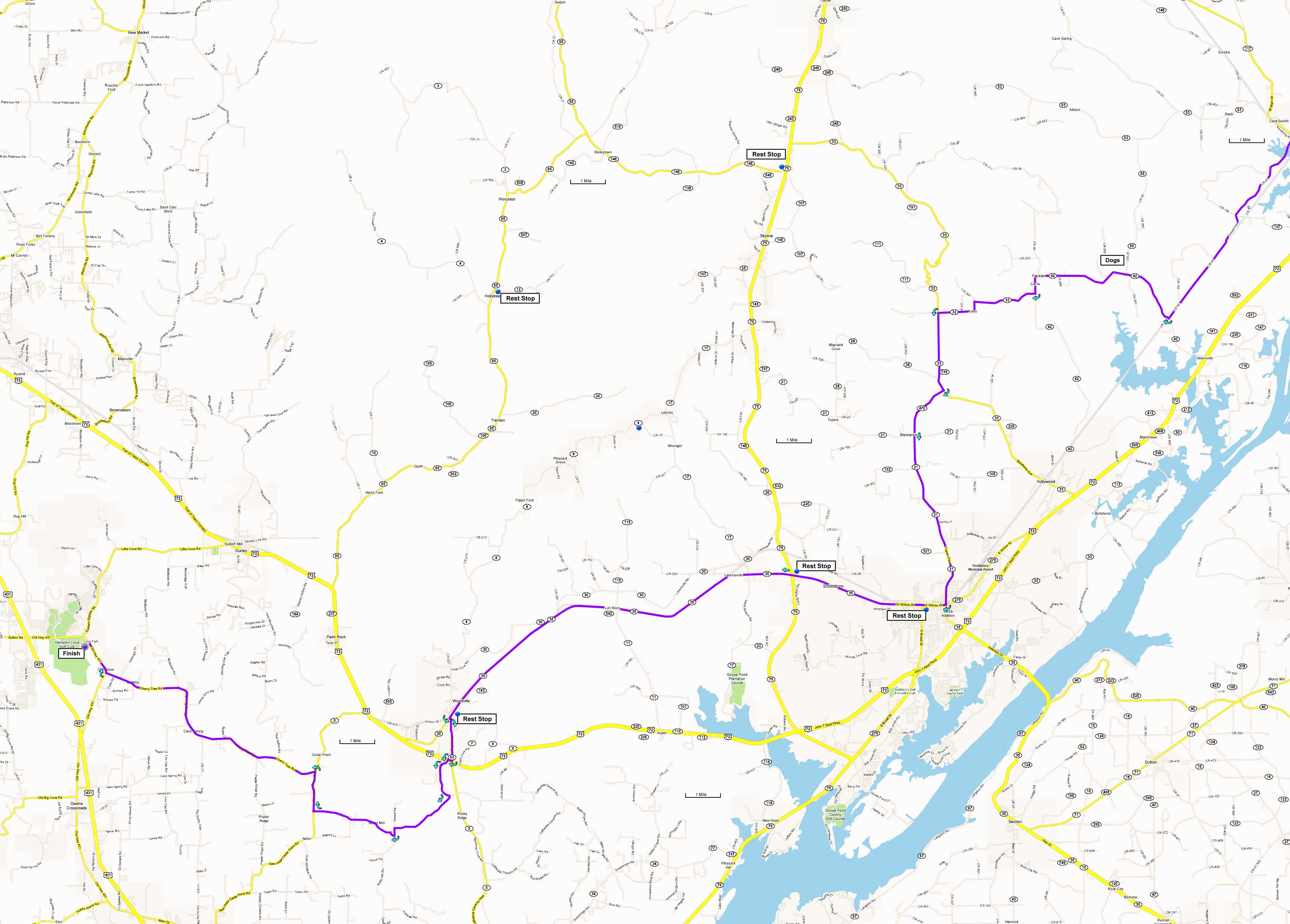
AL-35 between Scottsboro and Woodville is a long straight road without much variation in the scenery. A more interesting road, AL-30, parallels AL-35 after Larkinsville, but it has rougher pavement and meanders a bit.

After Woodville the route works it's way through some quiet country roads on good pavement. Just before the finish at Cove Park ballfields there are some one-way bridges, use caution as oncoming traffic has no yield signs.

Chattanooga to Huntsville, Fast, second Half
        Directions to start:

Downtown Chattanooga, a couple of blocks south of the Tennessee Aquarium, the intersection of Market Street and East 4th Street.

       
Printable cue sheet Google Earth file:
KmzChaHsvFast.zip
Maps: Page 1
Page 2

Miles Turn  Description Leg
0.0 South  from East 4th Street on Market Street, go 5 blocks 0.5
0.5 Right  on West 9th Street / ML King Blvd, go 1 block 0.1
0.6 Left  on Broad Street / TN-2 2.3
2.9 Continue  Broad Street becomes US-41 / US-11 / Cummings Highway 2.9
5.8 Left  on Wauhatchie Pike 2.8
8.6 Left  on US-11 / US-41 / Birmingham Pike 1.1
9.7 Right  on GA-299 3.4
13.1 Continue  GA-299 becomes TN-134 at the Tennessee state line 6.1
19.2 Left  on TN-156 / Shellmound Road
(Warning: watch for expansion joints on bridge entering South Pittsburg at 29.5 miles)
10.8
30.0 Left  on TN-27 / N Cedar Ave 1.5
31.5 Rest Stop  at convenience store in South Pittsburg -
31.5 Continue  on TN-27 / S Cedar Ave 1.2
32.7 Continue  TN-27 becomes AL-74 at the Alabama state line 1.0
33.7 Continue  on AL-74 / Rocky Springs Road 3.4
37.1 Right  on CR-75 5.0
42.1 Right  on E 2nd Street 1.5
43.6 Rest Stop  optional: Left 0.4 miles on Kentucky Ave to convenience store, adds 0.8 miles -
43.6 Right  on Kentucky Ave at light 0.1
43.7 Left  on E Main Street in Stevenson 0.5
44.2 Left  on CR-45 / Russell Pike 6.4
50.6 Right  on CR-42 5.1
55.7 Right  on AL-32 3.1
58.8 Left  on CR-33 2.2
61.0 Right  on AL-470 1.6
62.6 Rest Stop  Pikeville convenience store -
62.6 Continue  south on AL-21 5.1
67.7 Right  on AL-35 / AL-279 / E Willow Street 0.6
68.3 Rest Stop  in downtown Scottsboro -
68.3 Continue  west on AL-35 / AL-279 / E Willow Street 15.3
83.6 Rest Stop  at Woodville convenience store -
83.6 Continue  southwest on AL-35 0.1
83.7 Left  on AL-8 0.1
83.8 Right  on AL-63 / College Street 1.2
85.0 Right  on HWY-72 shoulder 0.1
85.1 Left  on AL-63 / Old Grant Road 0.2
85.3 Bear Left  on AL-108 / Jim Tom Hodges Road 1.2
86.5 Right  on Mill Road 2.2
88.7 Right  on Butler Mill Road 2.5
91.2 Right  on New Hope Cedar Point Road 1.1
92.3 Left  on Cherry Tree Road 7.5
99.8 Right  on Old Highway 431 1.2
101 Finish  at the Cove Park ballfields -