Traffic along most of the route is light. The two mile section along
[The non-reversed route travels north on AL-65 first, followed by a longer, less difficult climb up to Skyline, ending with the hilly CR-8 on top of Nat Mountain. That route is three miles longer because it circles around US-72 near Woodville to avoid the westbound lane's narrow shoulder.]
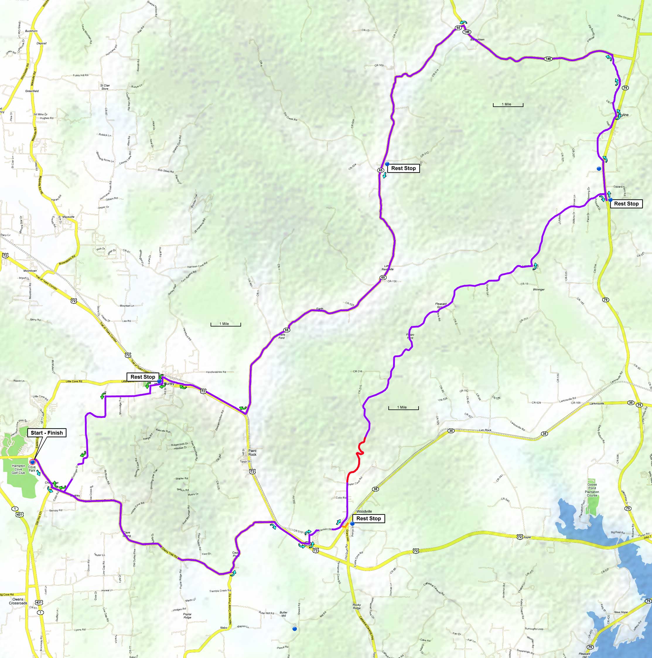
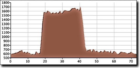
The climb up Nat Mountain starts at mile 16 and is two miles with a 9% average grade. The ride's total elevation gain is 2,400', starting at 580' with a maximum elevation of 1,710'.
| Cue sheet | Route map | Google Earth file: KmzSkylineCCW.kmz |
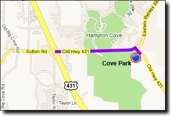
The Cove Park ballfields near Hampton Cove:
If traveling over Monte Sano on Highway 431 (east on Governors Drive): go 4.8 miles after passing Monte Sano Boulevard and turn Left at Old 431/Sutton Road. Travel 1.6 miles and turn right onto Old 431. The ballfields are on the right.
If traveling over Cecil Ashburn Drive: continue straight on Sutton Road for 0.7 miles and go straight across Highway 431. From the intersection go 1.6 miles and turn right onto Old 431. The ballfields are on the right.