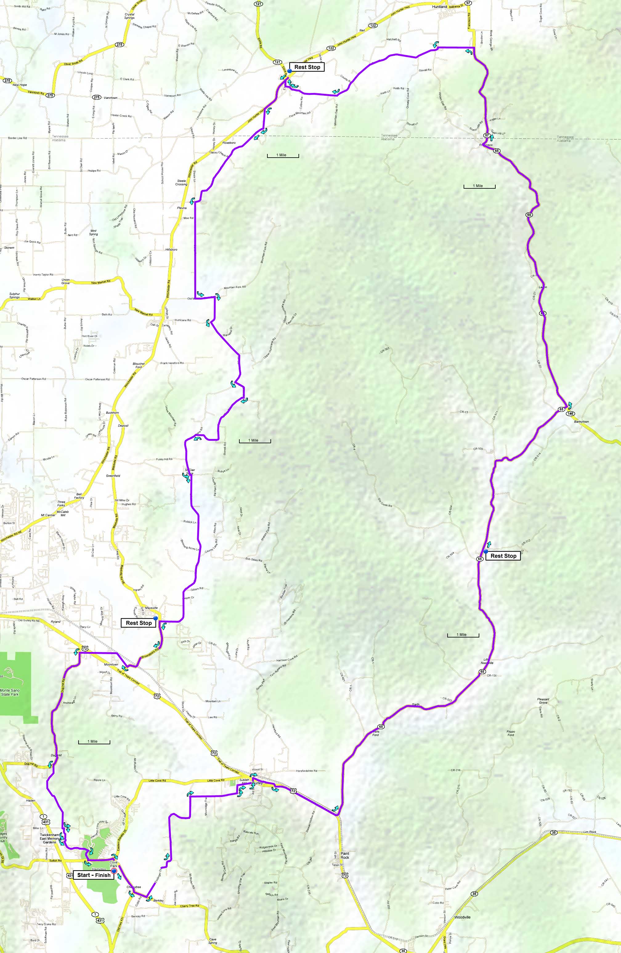
The route includes a two mile section on the shoulder of US-72. While not particularly pleasant due to the high speed traffic, the shoulder is wide enough to ride a reasonable distance from passing cars.
There are three rest stops fairly evenly spaced, 23 miles to Hollytree, 26 miles to Elora, and 22 miles to Maysville. There's also Mary's Pit Bar BQ located on Hurricane Creek Road just before the Maysville stop, open 10-6 W-S, 10-4 Sundays.
A 76-mile version of this ride travels clockwise and starts from the Madison County High School. A good hot weather option starts from Trenton on AL-65, the Shady Paint Rock 70.
| Cue sheet | Route map | Google Earth file: KmzPaintRock84.kmz |
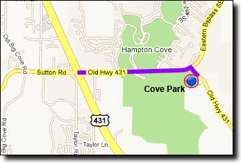
The Cove Park ballfields near Hampton Cove:
If traveling over Monte Sano on Highway 431 (east on Governors Drive): go 4.8 miles after passing Monte Sano Boulevard and turn Left at Old 431/Sutton Road. Travel 1.6 miles and turn right onto Old 431. The ballfields are on the right.
If traveling over Cecil Ashburn Drive: continue straight on Sutton Road for 0.7 miles and go straight across Highway 431. From the intersection go 1.6 miles and turn right onto Old 431. The ballfields are on the right.