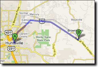
The route includes an unavoidable two mile section on the shoulder of Highway 72. While not particularly pleasant due to the high speed traffic, the shoulder is wide enough to ride a reasonable distance from passing cars. Unfortunately the shoulder also includes a rumble strip that narrows the rideable width.
There's also an 84-mile version of this ride, traveling counter-clockwise and starting from the Cove Park ballfields. A good hot weather option starts from Trenton on AL-65, the Shady Paint Rock 70.
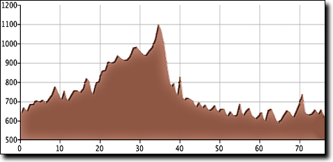
| Cue sheet | Route map |

Travel East on Highway 72 from Huntsville. Go 6.9 miles after passing the Moores Mill Road intersection (just after descending out of Huntsville). Turn Left on Brock Road and the Madison County High School is on your left after 0.2 miles. If you reach Gurley you've gone too far.
Google Maps driving directions to Madison County High School.