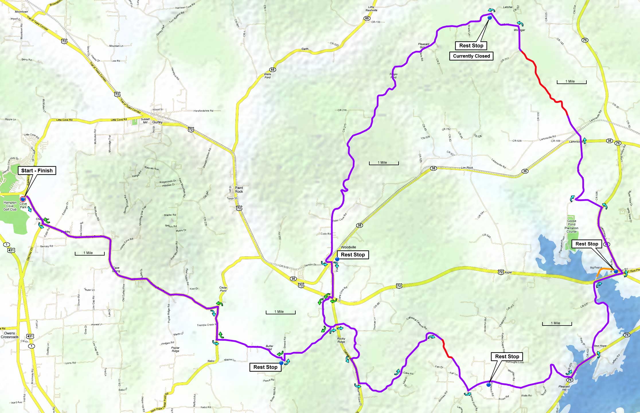
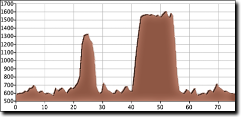
There are two major climbs, the first is Babe Wright up Grant at mile 22. The descent down off Grant on Swearengin five miles later includes a sharp switchback.
The total elevation gain is 3,020', starting at 580' with a maximum elevation of 1,610'.
Just after the convenience store at mile 33 there's an optional one mile out-and-back lakeside road, a nice detour if you're up for the extra mileage. If you'd like a shorter ride, skip the out-and-back to the loop by starting in Woodville for a 46 mile ride.
| Cue sheet | Route map | Google Earth file: KmzGrantNat.kmz |
BikeRouteToaster |
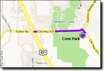
The Cove Park ballfields near Hampton Cove:
If traveling over Monte Sano on Highway 431 (east on Governors Drive): go 4.8 miles after passing Monte Sano Boulevard and turn Left at Old 431/Sutton Road. Travel 1.6 miles and turn right onto Old 431. The ballfields are on the right.
If traveling over Cecil Ashburn Drive: continue straight on Sutton Road for 0.7 miles and go straight across Highway 431. From the intersection go 1.6 miles and turn right onto Old 431. The ballfields are on the right.