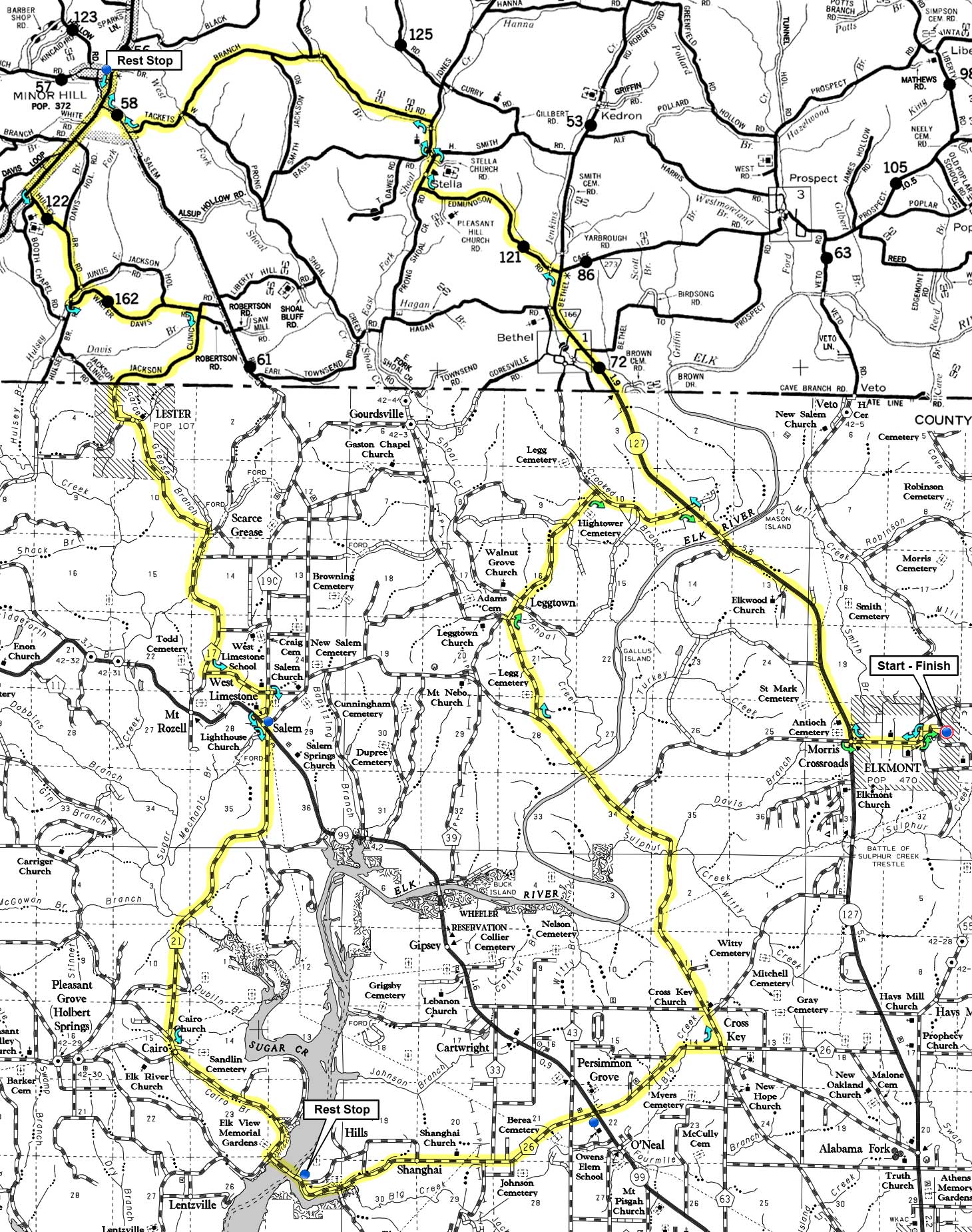
Cue Sheet Map - 2 Page RideWithGPS
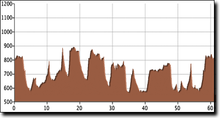
The total elevation gain is 1,920':
Thanks to Tim Storey for designing this route. For variations and other routes in the area, check Tim's RideWithGPS routes.
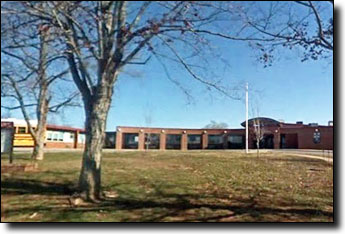
Elkmont High School, in Elkmont, Alabama:
Take Research Park Blvd North to AL-53, and turn Left / North on AL-53 for 11.6 miles. Turn Left on Ready Section / Bethel Road for 2.6 miles. Turn Left on Old US-31 / AL-251 S for 1.0 miles. Turn Right on Thach Road / CR-100 for 9.1 miles (becomes Sandlin Road west of I-65, and Upper Fort Hampton Road in Elkmont). Turn Right onto High School Road for 0.1 miles.