There is a reversed version of this route that tackles the climbs earlier in the ride.
There are three climbs on the route:
- Mile 24: 6 Mile Creek (topo) gains 405' in 0.9 miles for an average grade of 8.5%. This is a shaded climb on a quiet road with a few switchbacks. There are a few hills after the "top."
- Mile 36: Gandys Cove (topo) gains only 265' in 0.8 miles for an average grade of 6.3%; it's also shaded.
- Mile 53: Morrow Mountain (topo) gains 410' in 0.9 miles for an average grade of 8.6%. The grade varies so there are some steep sections and the pavement is rough, but it's lightly traveled and shaded as well.
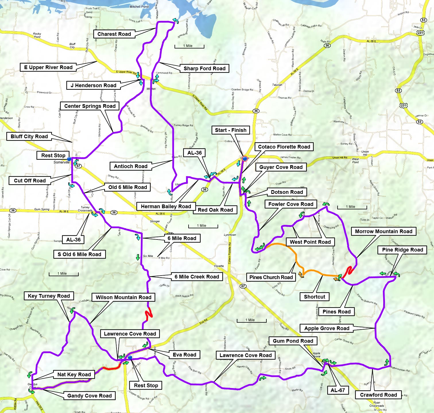
| Cue sheet | Route map | RideWithGPS |
Legend has it that Cotaco was the name of a Creek Indian chief in the area. The original pronunciation was Cuh-tauk-uh but the locals now pronounce it Co-TAY-co, with all long vowel sounds.

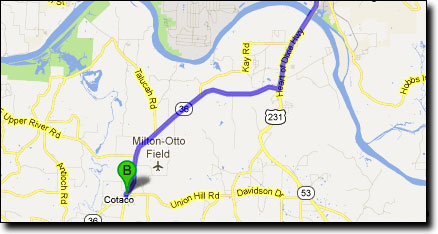
There is a 40 mile version of this ride with no climbs, shown here in blue. The first 22 miles are the same as this ride.

This ride begins at the Cotaco School parking lot, on Cotaco School Road off of AL-36, south of the Tennessee River. Travel South from Huntsville on